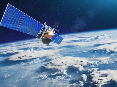
"People's" satellite from the Prytula Foundation. How will he help the Armed Forces?
Inhaltsübersicht

On Tuesday, August 18, it became known that the Serhiy Prytula fund purchased the ICEYE satellite for 600 million UAH, which it raised for "Bayraktary".
The ICEYE apparatus can take pictures of objects on Earth at any time and in any weather. In addition to the satellite, access to the manufacturing company's image database for a year was also purchased.
According to Serhiy Prytula, the satellite will allow the Ukrainian army to destroy the enemy, receiving images 24/7 and planning military operations.
Why is satellite important?
Before the start of the full-scale invasion, Ukraine purchased images from Chinese and Israeli optical satellites, which received information only in good weather and during the day. After February 24, the need to receive images at any time of the day increased. That is why the satellite of the Finnish company ICEYE will help increase the effectiveness of defeating the enemy, saving the lives of our soldiers and the civilian population, because it will receive data day and night under any cloud cover.
In the photo from the satellite, it will be possible to see camouflaged equipment, distinguish between dummies and artificial objects, and notice shelters.
How does a satellite work?
The satellite works on the basis of the synthesized radar aperture (SAR). The radar sends a signal to Earth that bounces off objects and returns to space. A special antenna, which is called a synthesized aperture, catches this signal and recognizes objects.
As noted by the Serhiy Prytula Foundation, the "people's" satellite will fly over Ukraine twice a day. The captured images are received exclusively by the Ukrainian side as the unique owner of the satellite. One picture covers an area of up to 225 square kilometers, which is larger, for example, than the area of Mariupol.
Who will receive satellite data?
Defence Intelligence of the Ministry of Defence of Ukraine will be the main user of information from the satellite. When the term of access to the database expires, the device will remain in full ownership of Ukraine. The seller company also provides insurance for the satellite, providing Ukraine with a similar device in case something happens to the purchased one.
What do we know about ICEYE?
ICEYE is a Finnish company founded in 2014. In 2018, it launched the first satellite, ICEYE-X1, which was equipped with a synthetic aperture radar. The following October, ICEYE began offering commercial access to its 1-meter SAR images. And in January 2022, the company already had 16 satellites in orbit.
Recommended articles
1 min
Für Flüchtlinge
2 min
Finance
How to transfer money from abroad to Ukraine: the most popular payment systems
Currently, there are several ways to transfer funds to Ukraine from abroad. These include transfers using the IBAN number, international transfer systems, and card-to-card transfers. Find out which payment systems are the most common among Ukrainians abroad and the procedure for transferring funds in each of them
20 Okt. 2024
More details1 min
Travel


